Northern Andes
This map shows the Northern Andes bioregion: the three mountain ranges and their valleys in Colombia, Venezuela and Ecuador. The black line encloses the land above 1,000 metres and the valleys between the ranges, from the Sierra Nevada de Santa Marta and the Cordillera de Mérida to the Huancabamba depression. From these mountains, water flows to the Caribbean Sea, the Pacific Ocean, Lake Maracaibo, the Orinoco and the Amazon. National borders are shown as dotted lines. Each blue dot gathers the videos and texts of a published story; the pencil circles mark the stories still to come.
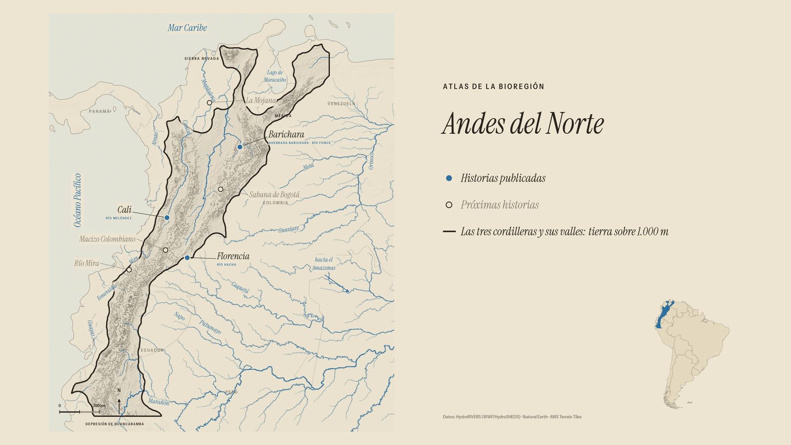
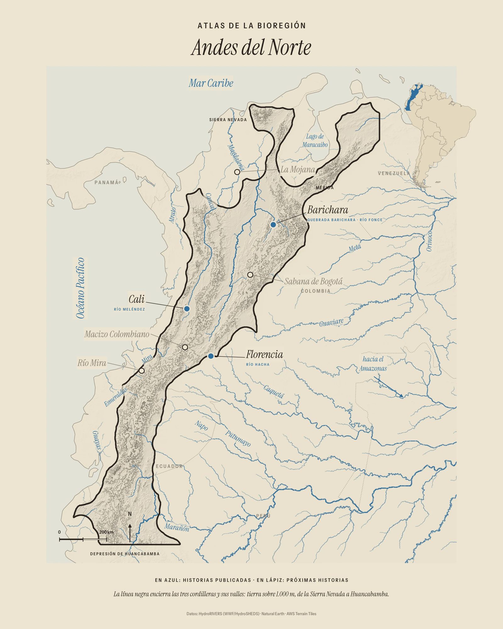

Published stories
Cali
Barichara and San Gil
Florencia
The whole bioregion: Bioregions Series
- 1: What Is a Bioregion?
- 2: The Northern Andes
- 3: One River, Many Worlds
- 5: Water People
- 6: The People the Mountains Kept
Upcoming stories
Colombian Massif · Bogotá savanna · La Mojana · Mira River